Attractions
Lhasa Region
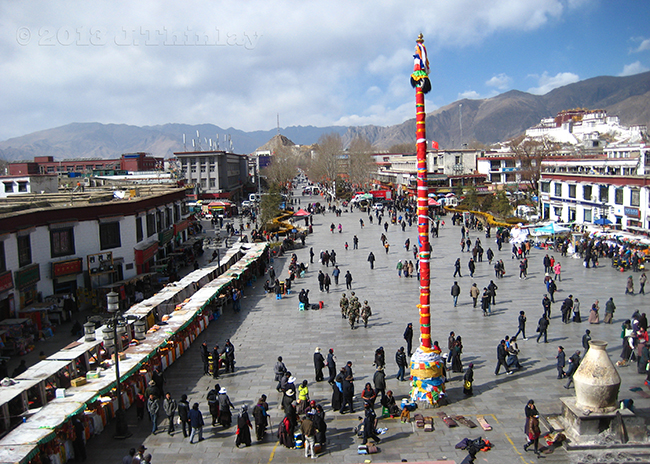
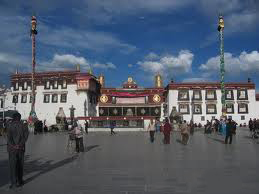
Lhasa, the capital city of Tibet, is considered to be a charming city with distinctive flavor. Visitors who first come here not only feel dizzy by its high altitude, but are also shocked by its rich historical and cultural relics, as well as the strong religious atmosphere marked by 1,300 years of history. Potala Palace, Jokhang Temple and Drepung Monastery have become the symbols of this ancient city. Strolling in the city, you may find it is a good example of the perfect combination of the religious and the secular.
Chamdo Region
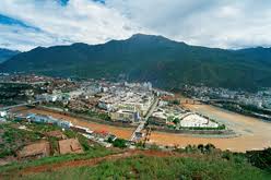
Located in the upper reaches of Lancang River, Chamdo Region occupies an important position. In Tibetan, "Chamdo" means "water confluence" as this place is the confluence of four rivers (Sequ River, Zhaqu River, Angqu River and Lancang River). Due to its old civilization, pious religious beliefs, long history, and unsophisticated folkways, Chamdo has attracted an increasing number of scientists, visitors and Mountaineers every year.
Chambaling Monastery
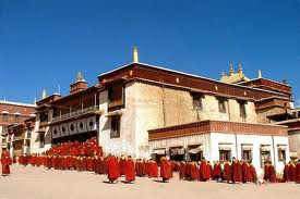
The monastery, in Chamdo Town, was founded in 1444 by one of Tsong Khapa's disciples. Chambaling has hundreds of statues of Buddhas and great adepters, thousands of square meters of murals, and magnificent Thangkas, which represent the highest artistic level in Kham. The most famous ceromony held at the monastery is its religious dancing, characterized with ferocious and living masks, elegant postures, gorgeous costumes and grant scenes.
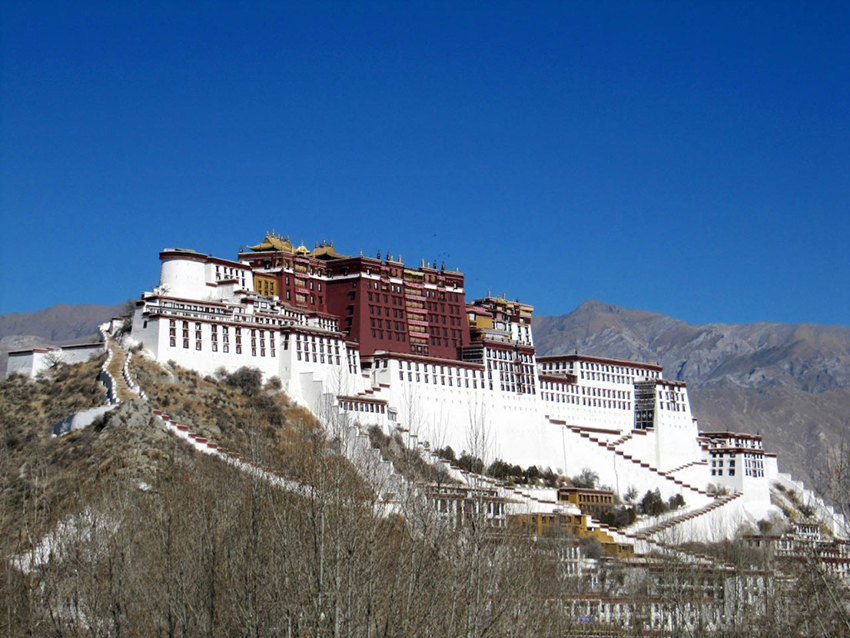
Potala Palace
The Potala Palace was the chief residence of the Dalai Lama. Lozang Gyatso, the Great Fifth Dalai Lama, started the construction of the Potala Palace in 1645 after one of his spiritual advisers, Konchog Chophel (died 1646), pointed out that the site was ideal as a seat of government. The Potala Palaca is between Drepung and Sera monasteries and the old city of Lhasa. It may overlay the remains of an earlier fortress, called the White or Red Palace, on the site built by Songtsen Gampo in 637. The building measures 400 metres east-west and 350 metres north-south, with sloping stone walls averaging 3 m. thick, and 5 m. (more than 16 ft) thick at the base, and with copper poured into the foundations to help proof it against earthquakes. Thirteen stories of buildings – containing over 1,000 rooms, 10,000 shrines and about 200,000 statues – soar 117 metres (384 ft) on top of Marpo Ri, the "Red Hill", rising more than 300 m (about 1,000 ft) in total above the valley floor. The Potala Palace was inscribed on the World Heritage List in 1994.
Heavenly Lake Namtso
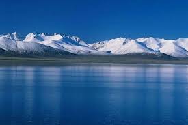
is a mountain lake on the border between Damxung County of Lhasa Prefecture and Baingoin County of Nagqu Prefecture in the Tibet Autonomous Region of China, approximately 112 kilometres (70 mi) NNW of Lhasa. Namtso was born in the Paleogene age, as a result of Himalayan tectonic plate movements. The lake lies at an elevation of 4,718 m, and has a surface area of 1,920 square kilometres. This salt lake is the largest lake in the Tibet Autonomous Region. However, it is not the largest lake in the Qinghai-Tibet Plateau. That title belongs to Qinghai Lake (more than twice the size of Namtso); which lies more than 1,000 km [650 miles] to the north-east, Qinghai province.
Jokhang Temple
is located in Barkhor Square in Lhasa. For most Tibetans it is the most sacred and important temple in Tibet. It is in some regards pan-sectarian, but is controlled by the Gelug school. The temple's architectural style is a mixture of Indian vihara design, Chinese Tang Dynasty design, and Nepalese design.
It was founded during the reign of King Songsten Gampo. According to tradition, the temple was built for the two brides of the king, Princess Wencheng of the Chinese Tang Dynasty and Princess Bhrikuti of Nepal. Both wives are said to have brought important Buddhist statues and images from China and Nepal to Tibet as part of their dowries, and they were housed here. Many Nepalese artists worked to construct this temple.
During the Bon period of Tibet the temple was (and sometimes still is), called the Zuglagkang (House of Religious Science or House of Wisdom). The term zuglag refers to the 'sciences' such as geomancy, astrology, and divination which formed part of the pre-Buddhist shamanistic religion now referred to as Bon. It is more commonly known today as the Jokhang, which means the 'House of the Buddha'.
Nakchu Region
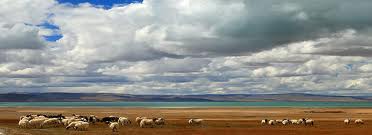
Located in the northern part of the high land, Nakchu leaves a strong impression to visitors by its vast Qiangtang Grassland and no man's land. Though it is a wild place with a small population and harsh weather conditions, its unique charm and magnificent view are the reason why people come here. What's more, in this mysterious land, much wildlife is under first national protection, adding some vitality to the land.
Ngari Region
Located in the extreme western part of the snowy land, Nagri stands at the highest part of the Qinghai-Tibet Plateau. Because of the high altitude, the land is severely cold and dotted by a continuous stretch of snow mountains. Though the color of it remains white, the celestial and extraordinary snow-capped landscape irresistibly attracts the brave to conquer and to seek the beauty of the wilderness.
Mt. Kailash and Lake Manasarova
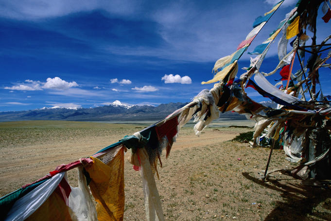
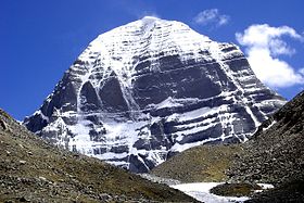
is a peak in the Kailas Range (Gangdisê Mountains), which are part of the Transhimalaya in Tibet. It lies near the source of some of the longest rivers in Asia: the Indus River, the Sutlej River (a major tributary of the Indus River), the Brahmaputra River, and the Karnali River (a tributary of the Ganges River). It is considered a sacred place in four religions: Bön, Buddhism, Hinduism and Jainism. The mountain lies near Lake Manasarowar and Lake Rakshastal in Tibet.The Tibetan name for the mountain is Gangs Rin-po-che. Gangs or Kang is the Tibetan word for snow peak analogous to alp or himal; rinpoche is an honorific meaning "precious one" so the combined term can be translated "precious jewel of snows".
Ruins of Guge Kingdom
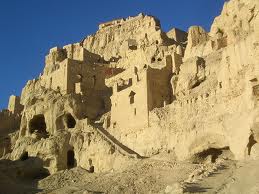
The ruins lie on a hilltop near a river and cover 180,000 square meters. Guge was an ancient kingdom in Western Tibet. The kingdom was centered in present-day Zanda County, within the Ngari Prefecture of Tibet. At various points in history after the 10th century AD, the kingdom held sway over a vast area including south-eastern Zanskar, Upper Kinnaur, and Spiti valley either by conquest or as tributaries. The ruins of the former capital of Guge kingdom are located at Tsaparang in the Sutlej valley, not far from Mount Kailash and 1,200 miles (1,900 km) westwards from Lhasa.
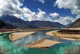
Yarlong Tsangpo River is a watercourse that originates at Tamlung Tso lake in western Tibet, southeast of Mount Kailash and Lake Manasarovar. It later forms the South Tibet Valley and Yarlung Tsangpo Grand Canyon, before passing through the state of Arunachal Pradesh, India, where it is known as the Dihang.
Downstream from Arunachal Pradesh, the river becomes wider and at this point is called the Brahmaputra River. From Assam (India) the river enters Bangladesh at Ramnabazar. From there until about 200 years ago it used to flow eastward and joined Megna River near Bhairavbazar. This old channel has been gradually dying. At present the main channel of the river is called Jamuna River, which flows southward to meet Ganges, which in Bangladesh is called the Padma.
When leaving the Tibetan Plateau, the Yarlung River flows in the world's largest and deepest canyon (bigger than the Grand Canyon), Yarlung Tsangpo Grand Canyon. The gorge has been described as "the highest river in the world" by the organizers of a kayaking expedition, although it's not clear from their press release what definition was used.
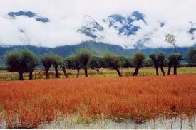
Nyingchi Region
Located in the eastern part, Nyingchi has long been known as "the South of Yangtze River in Tibet" due to its beautiful scenery. Unlike other landscape in this area, Nyingchi Region is rich in forest scenes and natural resources. Various plants growing in different climatic zones can be found here, such as banana trees, palm trees and snow lotus. Its thick forest is densely wooded by cypress, tree fern and Himalayan Fir, which makes the land worthy of the title "Natural Green Gene Pool" and "Natural Nature Museum".
Lhoka (Shannan)
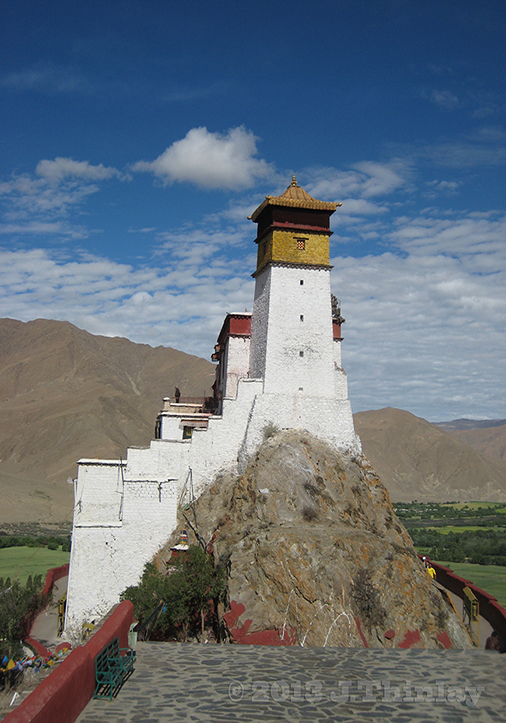
The Shannan Prefecture (lit. "south of the mountains") also known as the Lhoka Prefecture (Tibetan: ལྷོ་ཁ་ས་ཁུལ།, pinyin: Shānnán Dìqū) is a prefecture in the southeastern area of the Tibet Autonomous Region. The Shannan Prefecture has the Gonggar County, (alternatively "Gongkar", Tibetan: སྣེ་གདོང་རྫོང།, Wylie: gong-dkar rdzong; Pinyin: Gònggá Xiàn) under its jurisdiction with the Gonggar Choide Monastery, the Gonggar Dzong, and the Gonggar Airport near the Gonggar town. Located in the middle and lower stretches of the ancient Yarlung Valley, formed by the Yarlung Tsangpo River, the Shannan Prefecture is known as the birthplace of Tibetan civilization. It is bounded by prefectures of Lhasa on the north, Nyingchi to the east, Shigatse on the west, and the International border with India and Bhutan on the south. The prefecture measures 420 kilometres (260 mi) east to west and 329 kilometres (204 mi) from north to south. Its uniqueness is because the first farmland, the first palace and the first Buddhist monastery of Tibet are all located in the prefecture. It also has the distinction of holding the first Tibetan opera.
The Shannan Prefecture covers an area of 79,700 square kilometres (30,800 sq mi), which includes South Tibet, a disputed territory under the control of the Indian state of Arunachal Pradesh. Its topography is spread over an average altitude of 3,700 metres (12,100 ft). The prefecture has not only an ancient historical background but is also the most prosperous in Tibet.
Shannan is believed to be the richest region with the most profound culture. It is the cradle of the locals and the birthplace of their culture. It has countless historical and cultural relics, and has born many celebrities in history that made great contribution to the land. Moreover, the natural scenery here is equally wonderful. It is endowed with picturesque primitive forest, mysterious holy hill and lake, vast grassland and splendid mountains. Overall, it is a beautiful place combining sightseeing, scientific research, recreation and expedition as a whole.
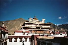
Samye Monasteryis the first Buddhist monastery built in Tibet, was most probably first constructed between 775 and 779 CE under the patronage of King Trisong Detsen of Tibet who sought to revitalize Buddhism, which had declined since its introduction by King Songtsen Gampo in the 7th century. The monastery is located in Dranang, Lhoka (Shannan) Prefecture. It was supposedly modeled on the design of Odantapuri monastery in what is now Bihar, India.
Samye Monastery Located in the western part of Tibet,
Situated in Dranang, Samye Monastery was completed in 779 under the patron of Trisong Detsen.
Yamdrok Yumtso Lake
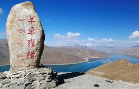
Yamdrok Yumtso (or Yamdrok-tso), one of the three holiest lakes on this holy land, lies at Nhagartse, located about 100 kilometers (62 miles) to the southwest of Lhasa.It is over 72 km (45 mi) long. The lake is surrounded by many snow-capped mountains and is fed by numerous small streams. The lake does have an outlet stream at its far western end.
Around 90 km to the west of the lake lies the Tibetan town of Gyantse and Lhasa is a hundred km to the northeast. According to local mythology, Yamdok Yumtso lake is the transformation of a goddess.
Yamdrok Lake, also known as Yamdrok Yumtso, has a power station that was completed and dedicated in 1996 near the small village of Pai-Ti at the lake’s western end. This power station is the largest in Tibet.
Shigatse Region
Located in southern Tibet, Shigatse is the second largest city in TAR. It is also the monastic home of the Panchen Lama. Lying at the foot of the northern slope of the Himalayas, it is endowed with fertile farmlands, vast grassy meadows, wooded forests and snow mountains. Moreover, the old civilization and magnificent temple architectures are the other reason for visitors to come here.
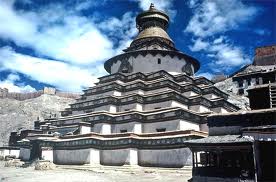
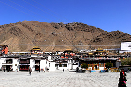
Tashilhunpo Monastery founded in 1447 by Gendun Drup, the First Dalai Lama, is a historic and culturally important monastery next to Shigatse, the second-largest city in Tibet.
It was sacked when the Gurkhas invaded Tibet and captured Shigatse in 1791 before a combined Tibetan and Chinese army drove them back as far as the outskirts of Kathmandu, when they were forced to agree to keep the peace in future, pay tribute every five years, and return what they had looted from Tashilhunpo.
The monastery is the traditional seat of successive Panchen Lamas, the second highest ranking tulku lineage in the Gelukpa tradition. The "Tashi" or Panchen Lama had temporal power over three small districts, though not over the town of Shigatse itself, which was administered by a dzongpön (prefect) appointed from Lhasa.
Located on a hill in the center of the city, the full name in Tibetan of the monastery means: "all fortune and happiness gathered here" or "heap of glory".
Mt. Everest
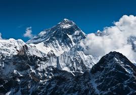
is the Earth's highest mountain, with a peak at 8,848 metres (29,029 ft) above sea level and the 5th tallest mountain measured from the centre of the Earth. It is located in the Mahalangur section of the Himalayas.
Situated at the border between Tibet and Nepal, Mt. Everest, also known as Mt. Qomolangma, meaning Mother Goddess of the Universe in local language. Mount Everest attracts many highly experienced mountaineers, as well as capable climbers willing to hire professional guides. While not posing substantial technical climbing challenges on the standard route, Everest presents dangers such as altitude sickness, weather and wind.
Mt. Everest has long been the ultimate height challenged by the brave from home and abroad.
